


Fitzgerald Biosphere Coast Regional Map
Scan QR code to Download page as a pdf
The southern portion of Hamersley Drive is a sealed road that winds along a beautiful part of the coast between Hamersley Inlet and the park’s eastern boundary linking: Four Mile Beach, Barrens Beach, Barrens Lookout, East Mylies, Mylies Beach, Cave Point and West Beach. This is the only sealed road in the Fitzgerald River National Park that allows year round access to the park’s key attractions and amenities including: Hamersley Inlet Campground (Shire managed) and 4 Mile Campground (DBCA managed). Fees apply.
If travelling to the beachside campgrounds of Mason Bay and Starvation Bay from Hopetoun, Southern Ocean Road is sealed up to 12 Mile Beach with the remainder gravel and accessible by 2WD. Gravel road condition can vary, so please drive to the conditions. During a heavy wet weather event that causes localised flooding, the Shire may close Southern Ocean Road for short periods.
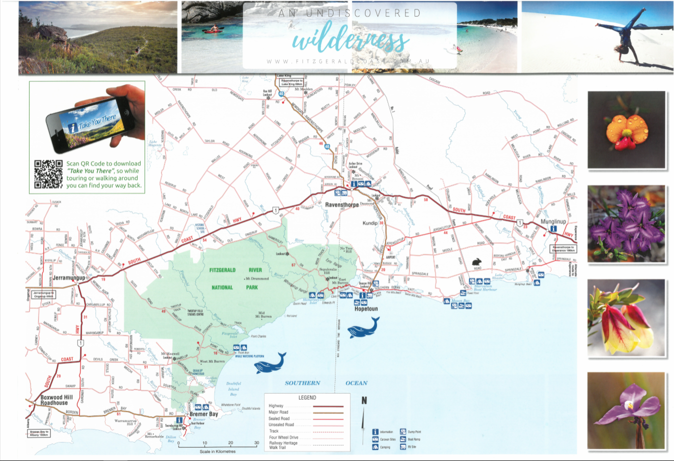